Type an address, run a takeoff in seconds
Bobyard reads aerial images to detect asphalt, sidewalks, stalls, and more, then rolls it all into an estimate.

Cut your takeoff in half
Bobyard can read any aerial image
Enter the property address and Bobyard pulls premium high-resolution aerial imagery from Nearmap and Vexcel with the parcel boundary pre-loaded. Bidding a portfolio? Bulk upload lets you add every address at once.

AI detects the full paving scope in minutes
Asphalt, sidewalks, parking stalls, ADA stalls, crosswalks, arrows, stop bars, and hatching get detected and measured in the units you price with. Estimators can verify each detection before locking it in.

Roll everything into a bid-ready estimate
All quantities flow directly into an estimate table that converts to tonnage for paving and gallons for sealcoating, with room for mobilization and markup.

Cut your takeoff time in half
computer visionBobyard can read any aerial image
Enter the property address and Bobyard pulls premium high-resolution aerial imagery from Nearmap and Vexcel with the parcel boundary pre-loaded. Bidding a portfolio? Bulk upload lets you add every address at once.

Double your bids
Estimators cut takeoff time by 50–90%, so they can chase and win the work they used to leave on the table.

Profit margins, not error margins
Custom AI models trained on paving properties detect with high accuracy, so you don't have to bake in miscount error margins.

Bigger business, same team
Bobyard doesn't replace estimators, it supercharges them. Free from counting they can focus on winning over clients and bids.
Double your bids
Estimators cut takeoff time by 50–90%, so they can chase and win the work they used to leave on the table.
Profit margins, not error margins
Custom AI models trained on paving properties detect with high accuracy, so you don't have to bake in miscount error margins.
Bigger business, same team
Bobyard doesn't replace estimators, it supercharges them. Free from counting they can focus on winning over clients and bids.
Trained on millions of images. Ready for yours.
Asphalt & sidewalk takeoff

Auto-detects asphalt and sidewalk square footage, and turns those calculations into bid-ready numbers.
Stall & symbol counting

Get counts for standard, ADA, and truck stalls, arrows, stop bars, and stencils. No more counting one-by-one.
Striping & curb measurement

Generates lines, crosswalks, and hatching in linear or square feet, with length pulled from pavement edges.
Trained on millions of images. Ready for yours.
Asphalt & sidewalk takeoff
Auto-detects asphalt and sidewalk square footage, and turns those calculations into bid-ready numbers.
Stall & symbol counting
Get counts for standard, ADA, and truck stalls, arrows, stop bars, and stencils. No more counting one-by-one.
Striping & curb measurement
Generates lines, crosswalks, and hatching in linear or square feet, with length pulled from pavement edges.
Spec & RFI Chatbot
Ask Bob anything in your specs, drawings, or RFI log. He's read the whole project.
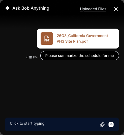
Spec & RFI Chatbot
Ask Bob anything in your specs, drawings, or RFI log. He's read the whole project.
Support like you're part of our team
We get hands-on to get you on board. Bobyard's so easy to use that you won't need us for long, but powerful enough that you won't want to work without it.

Support like we're part of your team
We get hands-on to get you on board. Bobyard's so easy to use that you won't need us for long, but powerful enough that you won't want to work without it.
FAQ
Bobyard for Aerial Paving Takeoff is AI-native takeoff and estimating software for commercial paving contractors. You can type an address and use our high-resolution aerial images from Nearmap and Vexcel or upload your own aerial images. It automates asphalt area, edge/curb detection, and parking lot striping counts (including ADA stalls) turning hours of manual measuring into minutes.
Bobyard has access to high-resolution aerial images from Nearmap and Vexcel which it can read like an estimator, while automatically detecting paving quantities like asphalt area, curb length, and striping elements. Estimators review the detected quantities instead of tracing or counting them by hand.
Yes. Bobyard automatically counts parking stalls by type (standard and ADA), plus arrows, crosswalks, stop bars, and wheel stops. Detection is built to prioritize accuracy on ADA stalls specifically, since they cost significantly more per unit.
No. Bobyard for Aerial Paving Takeoff works from aerial imagery. For condition-based work like crack or pothole assessment, a site visit is still typically needed, however.
Enter the property address and Bobyard pulls high-resolution aerial imagery with the parcel boundary pre-loaded. We partner with premium imagery providers Nearmap and Vexcel so you can take off every bid with the most precise, up-to-date view of the property. Bidding a portfolio? Bulk upload lets you add every address at once.
Bobyard Paving is currently focused on paving maintenance: striping, restriping, and sealcoating. Asphalt area and tonnage calculations from drawings are also live, supporting lighter installation work alongside maintenance.
FAQ
Bobyard for Aerial Paving Takeoff is AI-native takeoff and estimating software for commercial paving contractors. You can type an address and use our high-resolution aerial images from Nearmap and Vexcel or upload your own aerial images. It automates asphalt area, edge/curb detection, and parking lot striping counts (including ADA stalls) turning hours of manual measuring into minutes.
Bobyard has access to high-resolution aerial images from Nearmap and Vexcel which it can read like an estimator, while automatically detecting paving quantities like asphalt area, curb length, and striping elements. Estimators review the detected quantities instead of tracing or counting them by hand.
Yes. Bobyard automatically counts parking stalls by type (standard and ADA), plus arrows, crosswalks, stop bars, and wheel stops. Detection is built to prioritize accuracy on ADA stalls specifically, since they cost significantly more per unit.
No. Bobyard for Aerial Paving Takeoff works from aerial imagery. For condition-based work like crack or pothole assessment, a site visit is still typically needed, however.
Enter the property address and Bobyard pulls high-resolution aerial imagery with the parcel boundary pre-loaded. We partner with premium imagery providers Nearmap and Vexcel so you can take off every bid with the most precise, up-to-date view of the property. Bidding a portfolio? Bulk upload lets you add every address at once.
Bobyard Paving is currently focused on paving maintenance: striping, restriping, and sealcoating. Asphalt area and tonnage calculations from drawings are also live, supporting lighter installation work alongside maintenance.