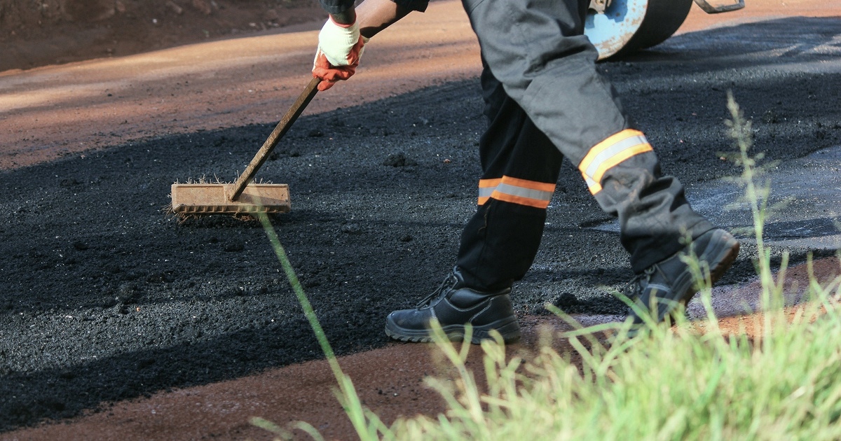
Bobyard for Paving Aerial Takeoff is a new custom suite of AI for commercial paving contractors to automate asphalt area calculation, edge and curb detection, and full parking lot striping counts (including ADA stalls) from aerial imagery to do paving maintenance.
Paving joins the Bobyard trade lineup
Today, Bobyard for Paving Aerial Takeoff is live. It's the fifth trade on the Bobyard platform, joining landscaping, electrical, finishes, and plumbing to bring custom-trained AI to another trade that's had to make do with manual measuring and counting for paving maintenance work.
Table of contents
- Why we built Bobyard for Paving Aerial Takeoff
- How Bobyard for Paving Aerial Takeoff works
- What's included in Bobyard for Paving Aerial Takeoff
- Top features and benefits
- See Bobyard for Paving on your own jobsite
- Bobyard for Paving Aerial Takeoff FAQ
Why we built Bobyard for Paving Aerial Takeoff
Counting stalls, arrows, and symbols across a commercial parking lot is one of the most repetitive, time-consuming parts of a paving maintenance bid. On top of that, the tools paving estimators use don't talk to each other. You pull an aerial image from Google Earth, then measure and count by hand in Bluebeam, and build the estimate separately in Excel or Heavy Bid.
How Bobyard for Paving Aerial Takeoff works
All you have to do is enter the property address, and Bobyard pulls high-resolution aerial imagery with the parcel boundary pre-loaded. We partner with premium imagery providers Nearmap and Vexcel so you have the most up-to-date view of any property. If you’re bidding a portfolio, bulk upload lets you add every address at once.
.gif) From here, Bobyard detects asphalt boundaries, calculates area and square footage or square yardage, and auto-computes tonnage by mix type. It also auto-detects asphalt edges and generates linear feet of curb automatically without hand tracing.
From here, Bobyard detects asphalt boundaries, calculates area and square footage or square yardage, and auto-computes tonnage by mix type. It also auto-detects asphalt edges and generates linear feet of curb automatically without hand tracing.
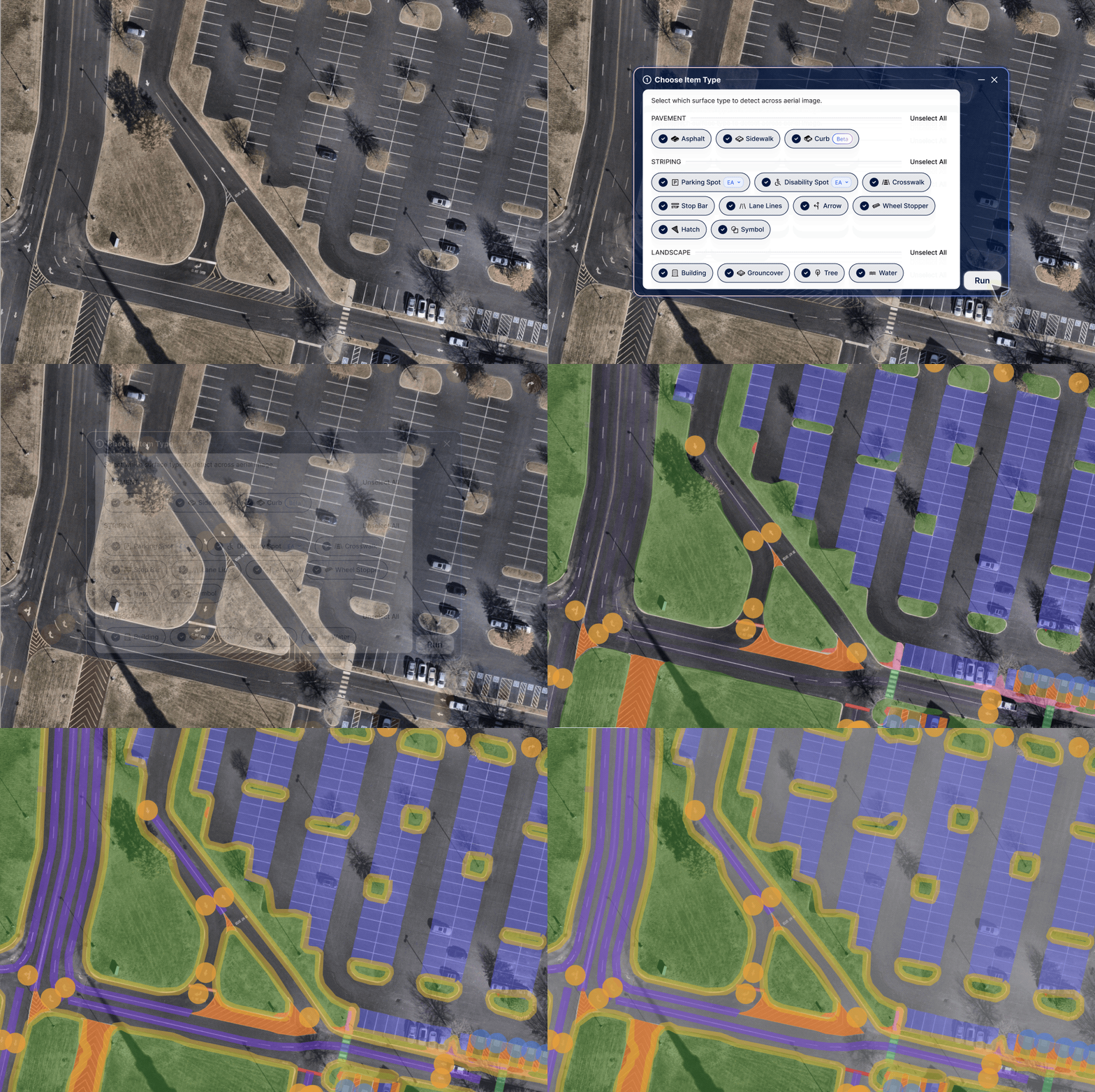
Then Bobyard finds and counts every striping element on the lot: parking stalls by type (standard and ADA), hatch areas, symbols and stencils, directional arrows, crosswalks, stop bars, wheel stoppers, and curb lines. Because ADA stalls carry the highest cost-per-unit and the highest bid risk, Bobyard's detection is built to prioritize accuracy here.
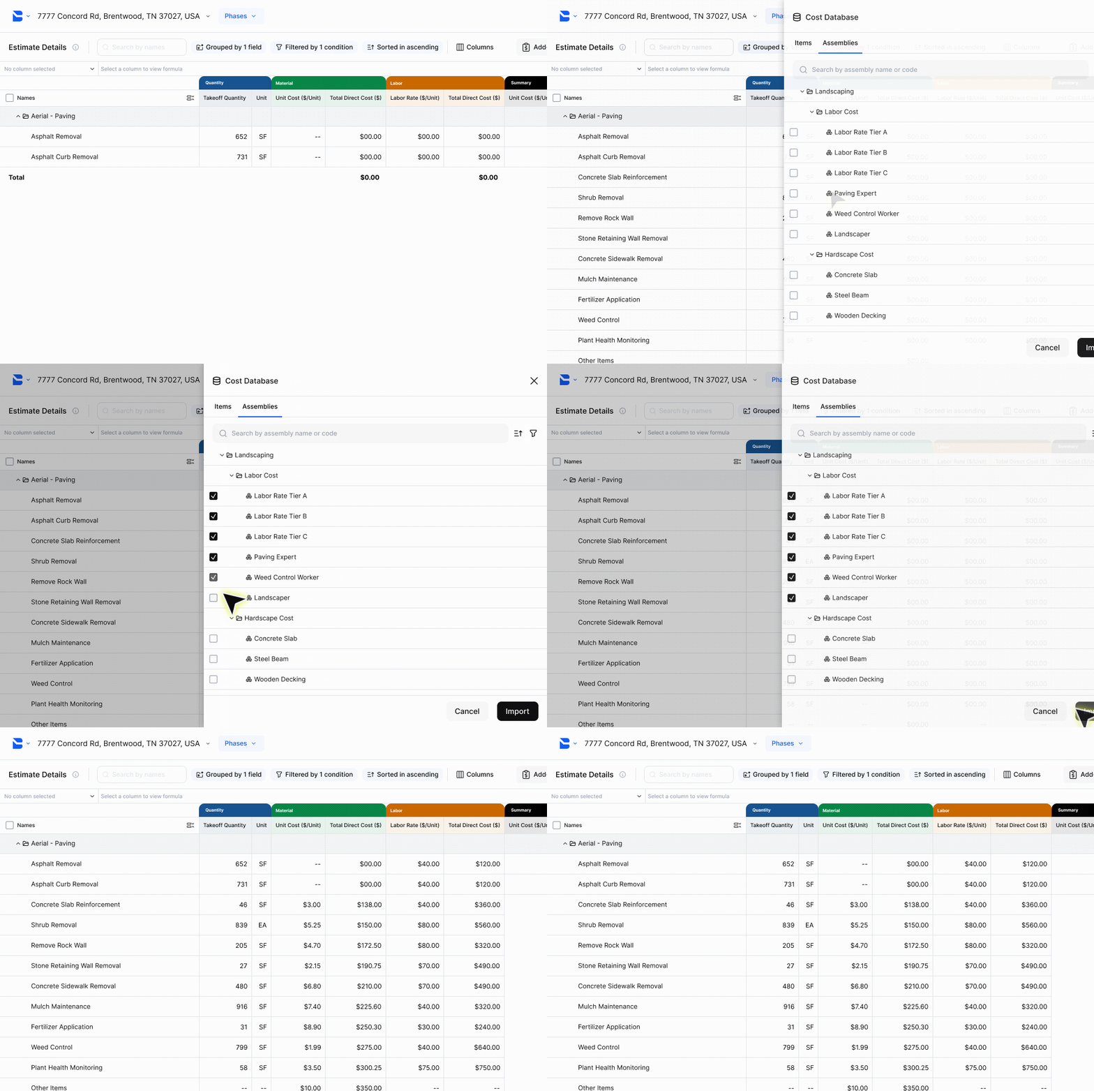
Estimators can review every detection before it locks in, and quantities flow straight into the Estimate Table with material and labor costs attached.
What's included in Bobyard for Paving Aerial Takeoff
- Asphalt takeoff: Draws area, calculates square footage and yardage, and auto-computes tonnage by mix type.
- Curb line detection: Auto-detects asphalt boundary edges and generates linear feet of curb automatically.
- Paved area: Calculates total SF of concrete or paved surfaces, including sidewalks.
- Parking stall counts: Differentiates standard vs. ADA/disability stalls.
- Striping element counts: Hatch areas, symbols and stencils, directional arrows, crosswalks, stop bars, and wheel stoppers.
- Edge detection: Choose the material (asphalt, sidewalk, etc.), and automatically detect edges for your choice.
- Landscaping aerial takeoffs: We also detect landscaping takeoff surfaces, like groundcover, trees, water, and more.
→ Check out a clickthrough demo of Bobyard for Paving
Top features and benefits of Bobyard for Paving Aerial Takeoff
Asphalt takeoff, automatically
Bobyard draws asphalt area directly from aerial images, calculates SF/SY, and auto-computes tonnage by mix type. Get the core calculation every paving bid depends on, done in a fraction of the time. Landscaping components are also included to calculate islands, etc.
Edge and curb detection
One click traces asphalt boundary edges and generates linear feet of curb, so what used to take 20+ minutes of manual tracing now takes one to two.
Full striping suite, from aerial imagery
Bobyard counts every element on a striped lot across: stalls, arrows, symbols, crosswalks, stop bars, and wheel stoppers directly from aerial imagery, without a site visit.
From takeoff to finished bid, in one place
Takeoff quantities flow straight into the Estimate Table with material and labor, backed by a built-in cost database, so you can prep your bid without leaving Bobyard.
See Bobyard for Paving Aerial Takeoff on your own jobsite
Bobyard automates the manual measuring and counting so paving estimators can focus on reviewing scope, pricing work, and helping them automate maintenance projects
If you're a paving estimator, book a demo and run your own jobsite through it live with our team. Contractors using Bobyard report an average of 50–90% faster takeoffs, and double the bids sent per estimator.
Even more trades are on the way
Paving follows Bobyard's recent launches of electrical, finishes, and plumbing, with mechanical/HVAC next (along with rolling updates to paving). Follow us on LinkedIn, YouTube, Instagram, and TikTok to stay in the know about new trade launches.
FAQ about Bobyard for Paving Aerial Takeoff
Can Bobyard’s AI perform paving takeoffs automatically?
Yes. Bobyard detects asphalt area, curb length, and parking lot striping elements (including stalls, ADA stalls, and symbols) directly from aerial imagery. Estimators review and adjust every detection before it's used in an estimate.
Does Bobyard for Paving Aerial Takeoff require a site visit?
Not necessarily. Bobyard works from aerial imagery without a site visit. A site visit is still typically needed for condition-based work like crack or pothole assessment.
What trades does Bobyard support today?
Bobyard currently supports estimating workflows across landscaping, electrical, finishes, plumbing, and paving, with mechanical and additional trade-specific workflows in development.
How does Bobyard compare to Bluebeam or Nearmap for paving takeoffs?
Unlike tools that only measure or only map, Bobyard uses AI trained specifically on paving to automate aerial-based takeoff in one workflow.